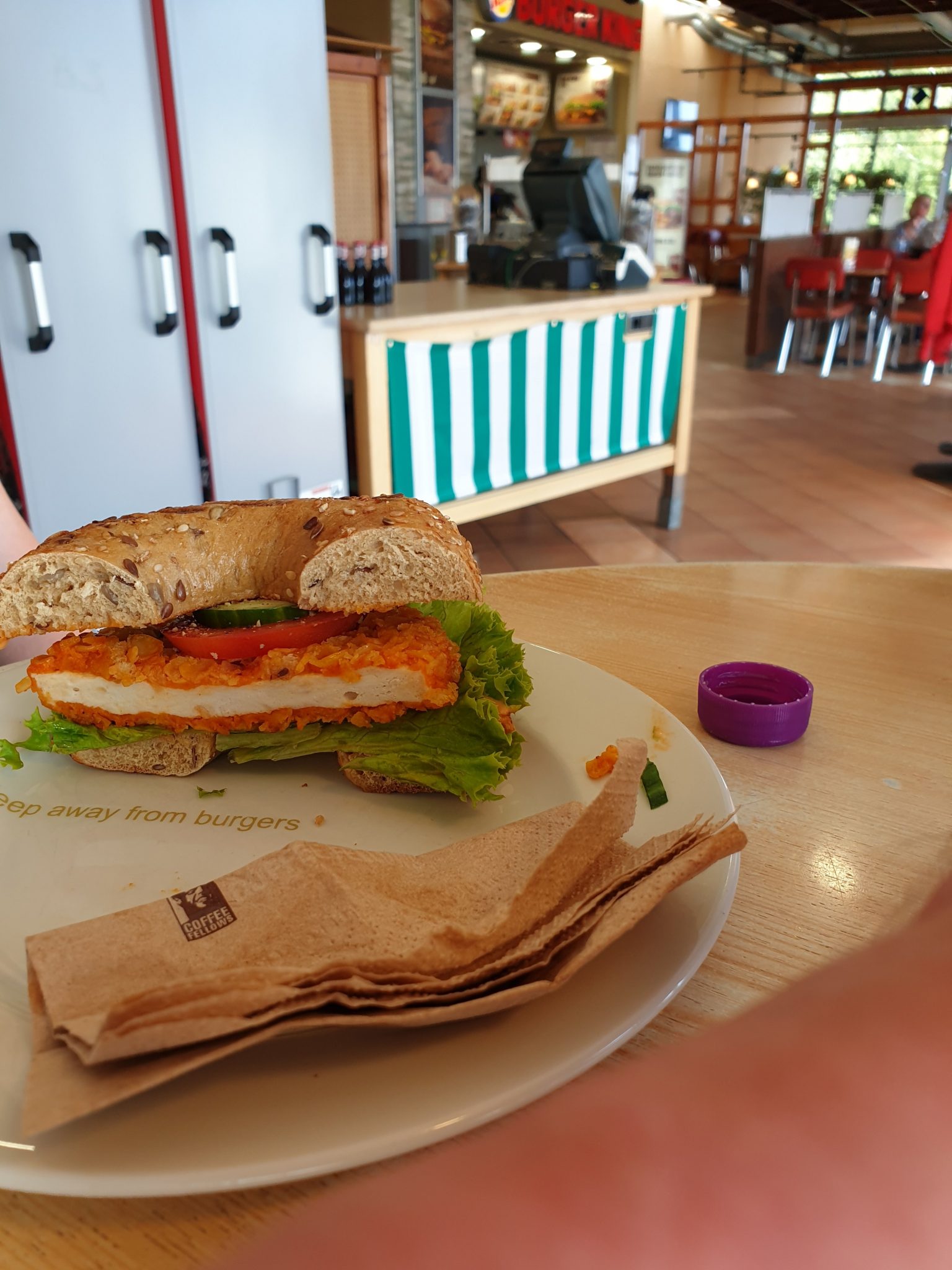
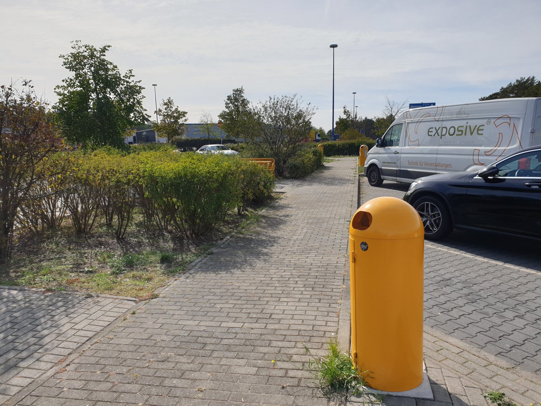
January has been a busy month both personally and professionally so I haven’t been able to take part in as many Quiztime challenges as I’d like to. Fortunately I had time to try Sector035’s Thursday Quiz. Sector035 posted not one but two photos. All we had to do was establish where exactly they were taken. Here are the two images:
So where to start? Sometimes a nice quick reverse image search will help to identify a location quickly, but no such luck in this case. Reverse image searching is an essential tool for geolocation work, but it still has an awful lot of limitations. Besides where’s the fun in finding everything with a reverse image search?
One useful method for finding photo locations is to try and extract as much information as possible from a photo and then use that to set some more detailed search parameters to home in on the location. It’s almost like a form of Boolean logic. If I can see that conditions X and Y are true in a photo, then searching for places where X and Y are true will help me find the location.
This sounds very simple in theory, but in practice it can be difficult because searching for some “true” information will still leave a very large pool of possible locations. If you saw the first photo and searched for “Burger King” and then “Germany” because of the writing on the van in the second photo, you would find hundreds of possible matches. This is because there are more than 700 Burger King restaurants in Germany, so it doesn’t really help you to determine where this could be.
Narrowing Down The Possibilities
The more “true” conditions you can identify in an image, the more specific your search will be. So for the first photo we’ve already seen that there is a Burger King, but we can also see that the napkin is from a Coffee Fellows outlet. The second photo also reveals a lot of “true” conditions that we can combine with these two and turn into search parameters:
1) The location appears to be some kind service area, based on the parked vehicles.
2) There is a van with German text on the side. Vehicles move, and Germany has borders with ten other countries, so by itself a German vehicle in a service area is not absolute proof that this is in Germany. It does make Germany a strong probability however.
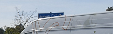
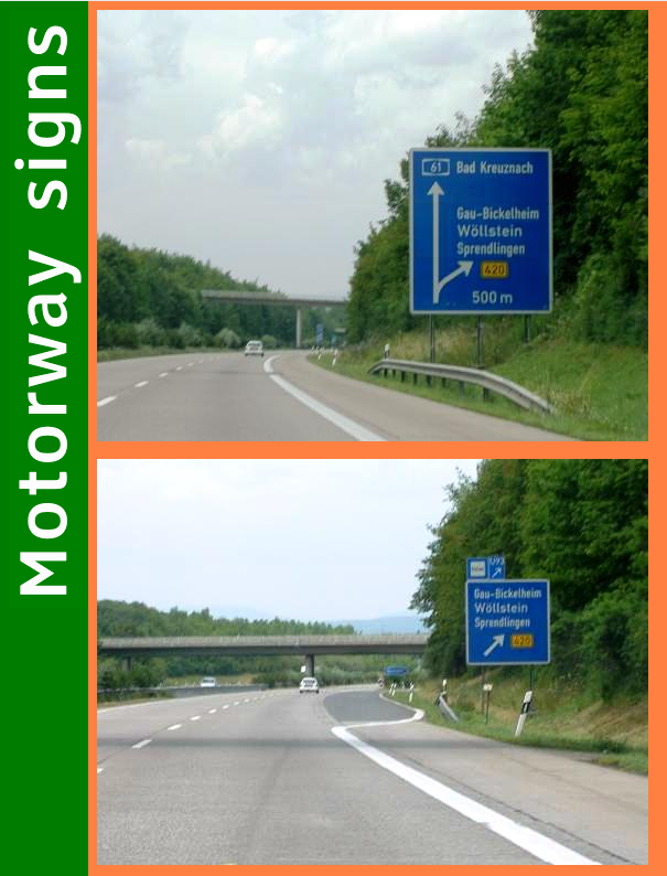
3) There’s a blue sign that says “Hannover 2”. Even if you have never visited Germany (and you really should), a quick Google will tell you that Hannover is in Germany. Moreover there are really useful sites like the Motorway Signs database which will help to show that this style of sign is common to Germany motorways. This means the sign is indicating the direction to Hannover along Autobahn 2 (A2).
4) There are yellow bins and also a yellow bench at the location.
With a little more data extracted from the photos, searching will be much easier and we will be able to find the location pretty quickly. All we have to do is put all our “true” conditions together and begin to search for them. We need to find a motorway service area on the A2 that has a Burger King, a Coffee Fellows, and is in the right direction of travel for Hannover. We also know that there will be yellow bins and a yellow bench at the location. These can be helpful for confirming the final position.
So how to begin finding the right service area? You could load up Google Maps out and start tracing a route along the A2, looking for a Burger King. The A2 stretches 473km across Germany and life is too short to do things this way. Instead we can use some of the details we identified and combine them into Boolean Google searches to help find the location. The more “true” conditions we can add, the more refined the results will be. For example:
This brings back too many results. Lots of other countries also have a motorway called the A2.
A little better. We are getting some specific service areas mentioned now. One of them will be correct, but we can still do more to refine the search by adding another true condition to our Boolean search:
“Coffee Fellows” + “Burger King” + a2 + Hannover
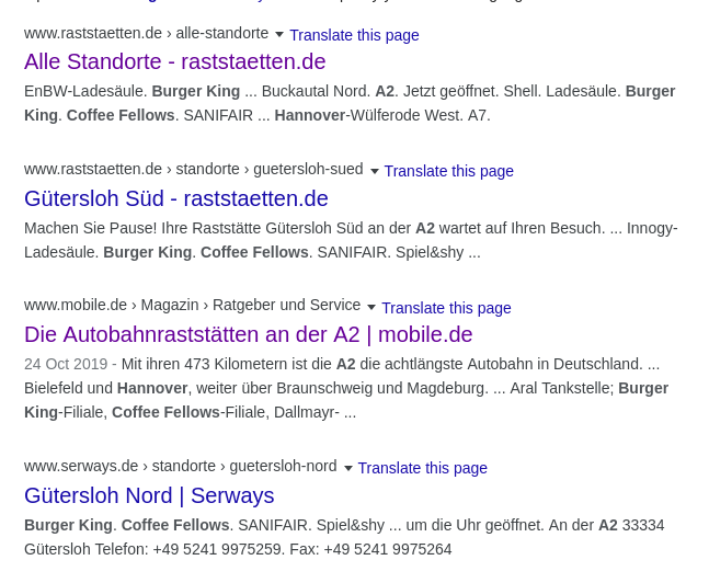
Just two service areas stand out from these results. One is at Gütersloh, and the other at Buckautal. We can quickly check these locations out with Google Maps to see if our theory is right. There’s no Street View coverage at Gütersloh, but there are quite a lot of images of the area uploaded to Google Maps. I can’t see any yellow bins though:
We established at the start that “yellow bin” must be a true condition of the right location. There are no yellow bins here like the one in the challenge photo, so unless we’ve missed something then logically this cannot be the location. So about Buckautal?
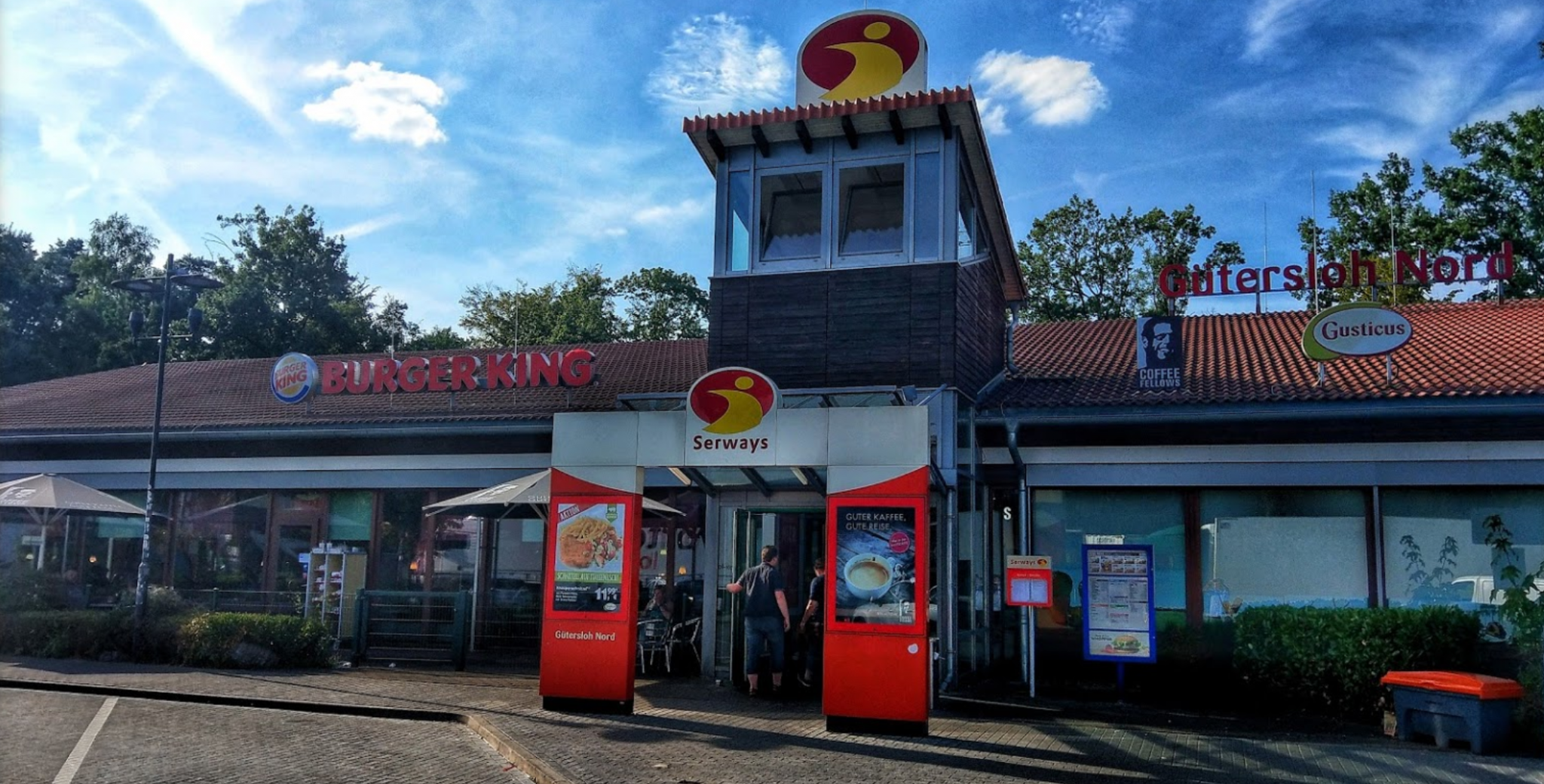
It has the exact same kind of yellow bins as those in Sector035’s picture. There’s no Street View coverage here, but there is a panoramic photo that we can use to try and verify if this is the location:
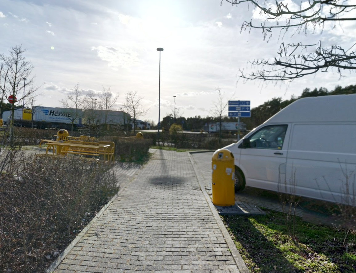
Perfect! We can compare this to the original and see that Sector035 took his challenge photo just a few steps away from where this picture was taken in 2017.