Geolocating images can be difficult. Sometimes the way to identify a location is not immediately obvious, but you can start with what you do know and then close the gaps to find out things that you don’t know and gradually get closer to your objective.
For example you might be fairly sure about the country or region that an image was taken in based on clues like the architecture or the landscape, but this might not necessarily tell you an exact city. Or sometimes you can work out the city, but you don’t know the precise street. Instead of hitting a dead end and giving up, you can start with a large area like a country or region and then refine your search parameters until you find the exact location.
I have written about this approach before, but last Wednesday’s Quiztime challenge is another good example of how this approach can be successful. Tilman wants to know the location of this garage door.
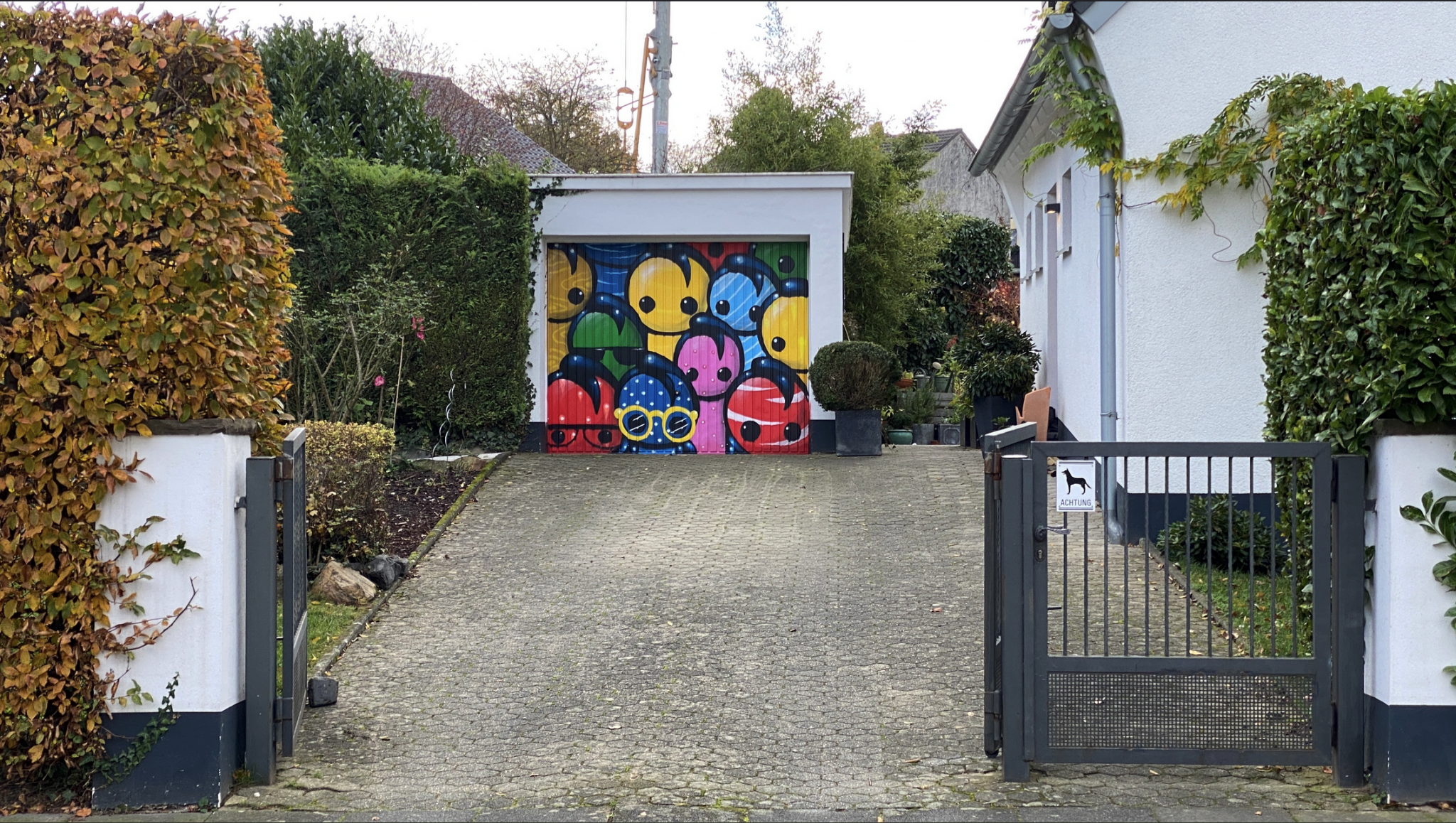
Unless you got very lucky with a reverse image search it would be quite difficult to find where this garage is. The “Achtung” sign on the gate tells you that image was taken in Germany (or possibly Austria), but you couldn’t easily identify a street, city, or even a region from this image alone.
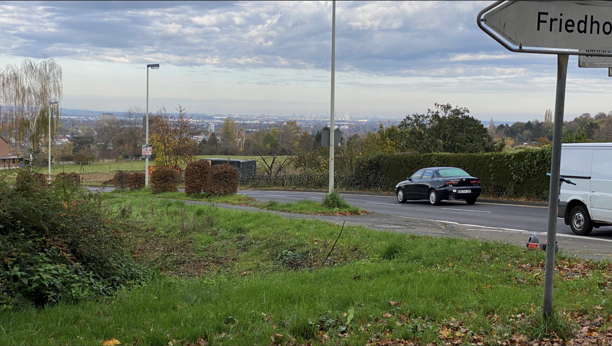
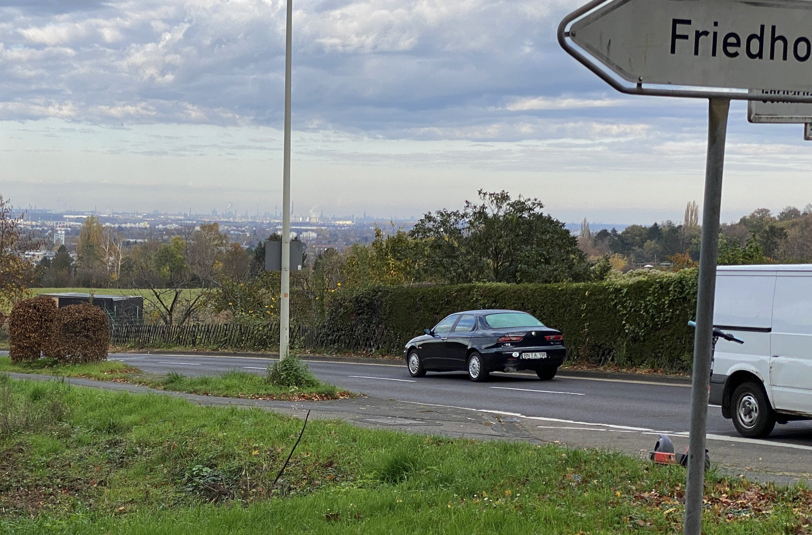
Fortunately Tilman also provides a large panoramic photo taken nearby that will help to find the location.
We can use this photo to start with a “big” location and then work our way down to a more precise local spot.
Starting Big
So where could this be? We’ve already seen one German language sign, and there are a few more in the other photo. The poster on the signpost sasys “Ja” (“Yes”) and there’s a partially-obscured sign that says “Friedho”. Given this is likely to be in Germany we can assume that the language is German,and a little Googling will show that this sign points towards a “Friedhof” (Cemetery) and not just a “Friedho”. If we know there is a cemetery nearby we can come back to this detail later on when we need to fine tune the location a little.
The car also helps to identify the area a little more precisely.
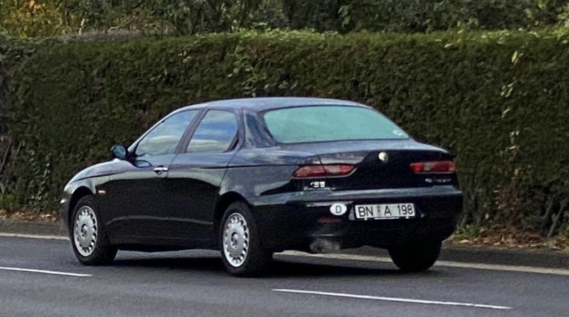
The “D” sticker on the bumper stands for Deutschland (Germany). Since Germany uses a geographic registration system, the “BN” gives us another clue – the car is registered in Bonn, in North-Rhine Westphalia. You can learn more about license plates of the world here, and all about the German license plate codes here.
Just a word of caution at this point. Although cars can provide a lot of geographic information, by their nature they are movable objects and are not always in the area that they originated from. It is always better to try and corroborate the location from other sources if possible. For an example of how this can cause confusion, have a watch of my walkthrough of a recent Quiztime solution where cars from several different countries were all parked together.
Finding the City
There are no other cars or other indicators that give precise location information. We can still be confident that this location is in Germany – but Germany is a big place and we need to be more precise than that!
To get closer to the exact spot we can work from a “big” location (Germany) and get smaller (North Rhine-Westphalia / Bonn) until we find a city. From a city, we can then work to a neighbourhood, and then finally a street.
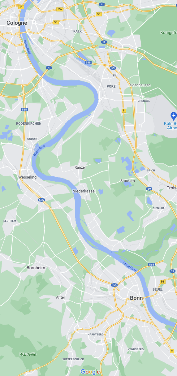
In the distance there is a large city – this will be crucial to decide where we search next, so which city is it? Here’s a map of North Rhine-Westphalia.
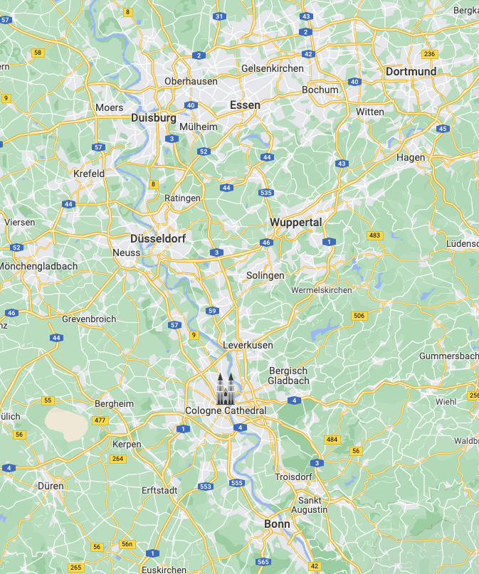
If we want to find a specific city there really could not a be worse region in Germany to try and find one. North Rhine-Westphalia has more large cities than any other region of Germany, but by being methodical we can still try and work out which is the most likely.
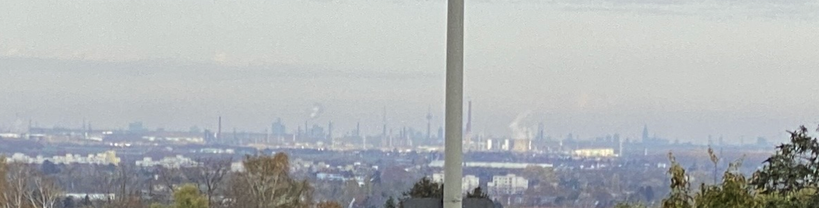
We can start with Bonn (where the car is registered to) and then compare the skyline of each city in the area until we find one that matches Tilman’s photo. Here’s the city skyline that we want to match:
There are a few different methods that can be used for identifying a specific skyline. A simple Google image search for “city name” + skyline will sometimes be enough to find a good match. Two other useful resources are Skyscraper Page and Phorio.
Skyscraper Page does not reproduce an exact skyline, but it does show what the tallest buildings in each city look like, as well as their relative height. These are the tallest buildings in Bonn:
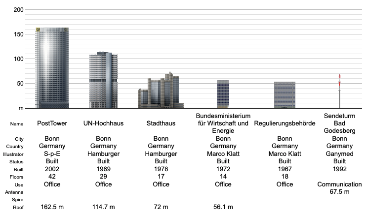
On first glance, none of these buildings appear on the horizon in Tilman’s photo. The distinctive TV tower in the centre and cathedral on the far right are not there, so it is unlikely to be Bonn.
Phorio is actually very helpful here, although not in a direct way. The Phorio page for Bonn has a skyline photo that looks like this:
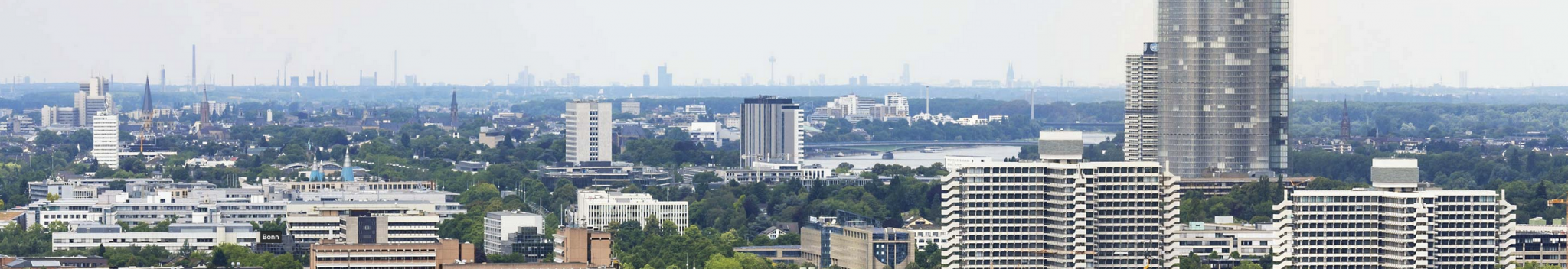
There is a TV tower and cathedral in the background of this image just like in Tilman’s photo – but there is one big issue here. Bonn is the city in the foreground of the Phorio image. The city in the background is a different city altogether. Looking on the map, there is only one city that it could be.
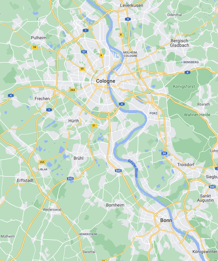
The TV tower and cathedral near to Bonn must be in Cologne. The tall TV tower is very distinctive, as is the famous Dom.
Getting Orientated
So far we have worked our way down from Germany to the Cologne/Bonn area. Since we know the city in the distance is Cologne, we can use Google Earth to get our bearings and work out roughly where Tilman was when he took the picture.
In Google Earth I marked the Colonius TV tower and the cathedral and drew a line between them. By lining them up so that they match the orientation of the photograph it will be possible to tell which way Tilman is facing, and therefore where his position is relative to Cologne.
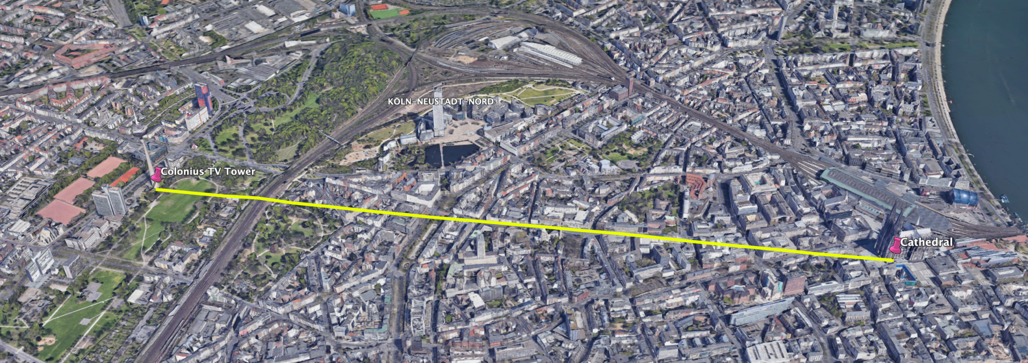
To match the orientation of the skyline in Google Earth with Tilman’s photo requires Colonius to be on the left, the Dom on the right and the KölnTurm (Cologne Tower) to appear the be roughly inbetween.
It is only possible to recreate this alignment from the south / south east of Cologne, so Tilman must have been in that area.
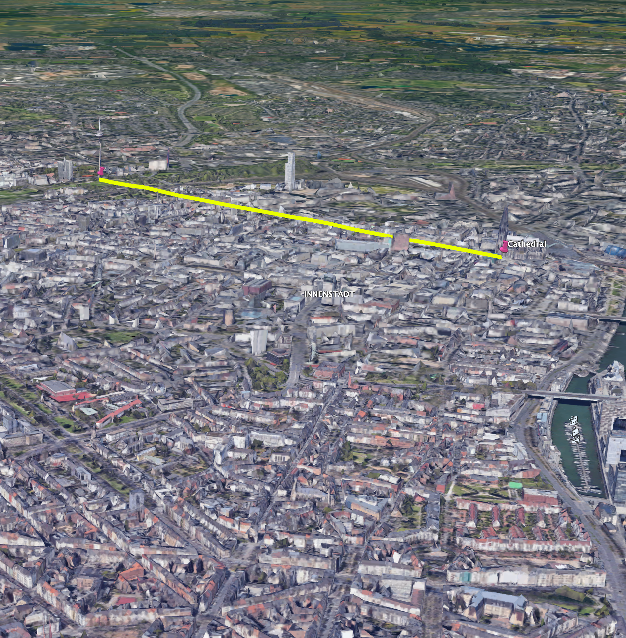
Tilman must be here somewhere:
Our search area is getting smaller and smaller – so where to look next? Way back at the start we identified that there was a cemetery (Friedhof) sign on the road. To find cemeteries in the area, we can zoom in with Google Maps and then enter “Friedhof” as a query.
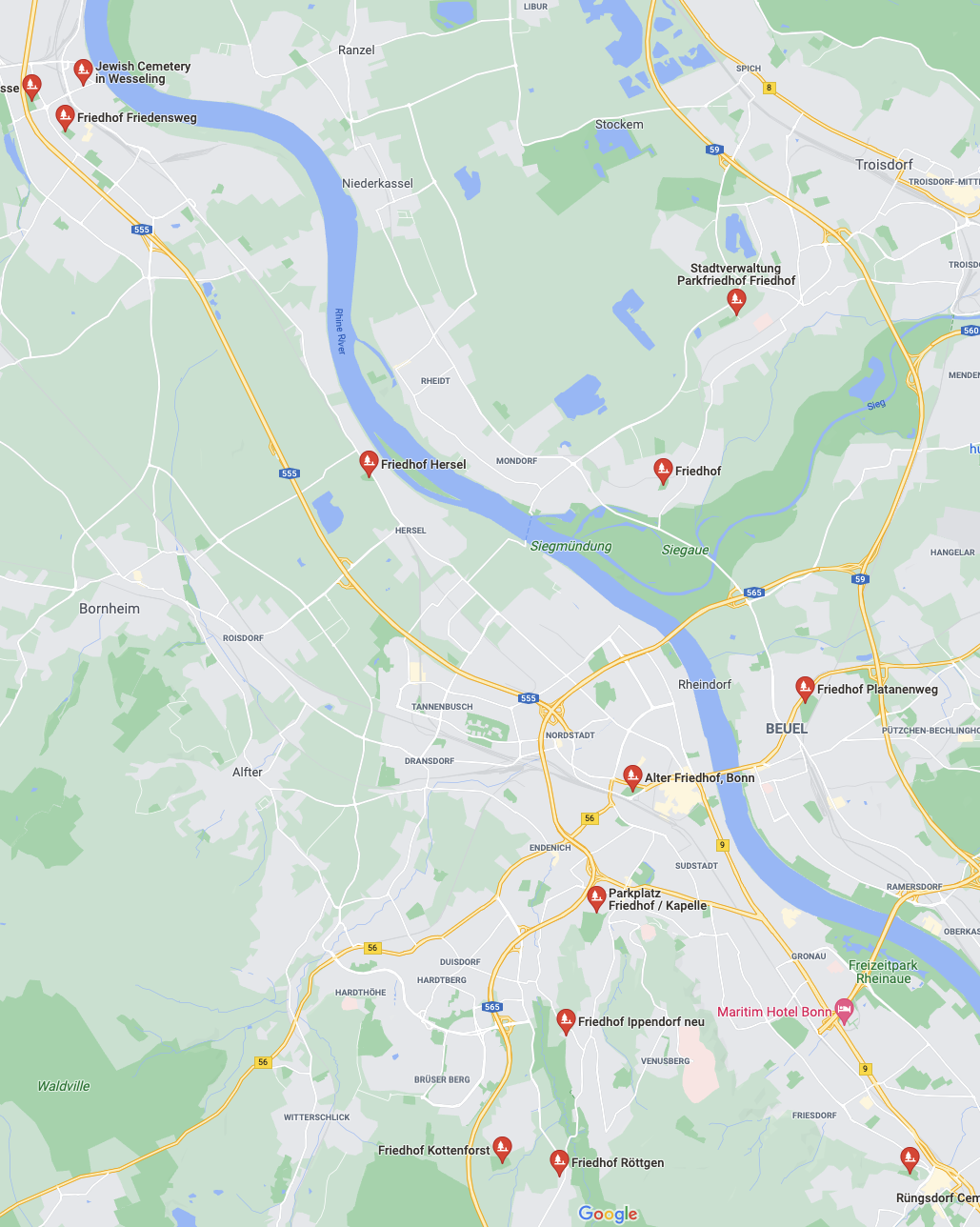
There are quite a few cemeteries in the area, but not so many that checking them all is too difficult. This area of Germany is unusual in that it has good Street View coverage, although none of the images are newer than 2009.
After a few false starts, there’s a match for the correct location at the junction of Im Acker / Ippendorfer Weg in the outskirts of Bonn. Let’s compare Street View with Tilman’s picture:
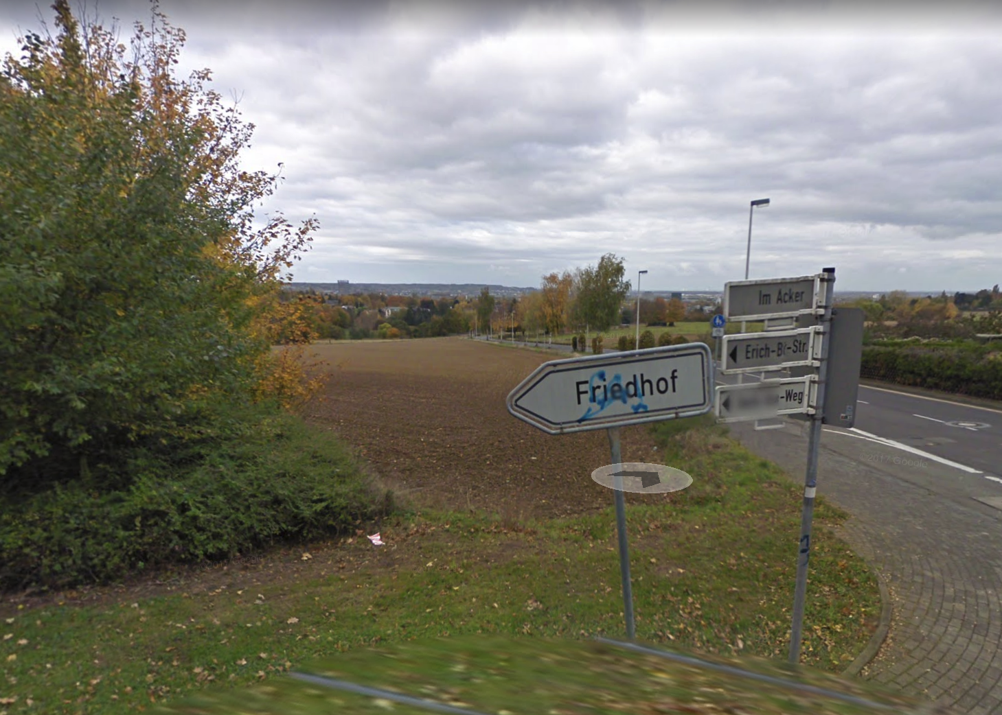
Not a perfect likeness, but close enough!
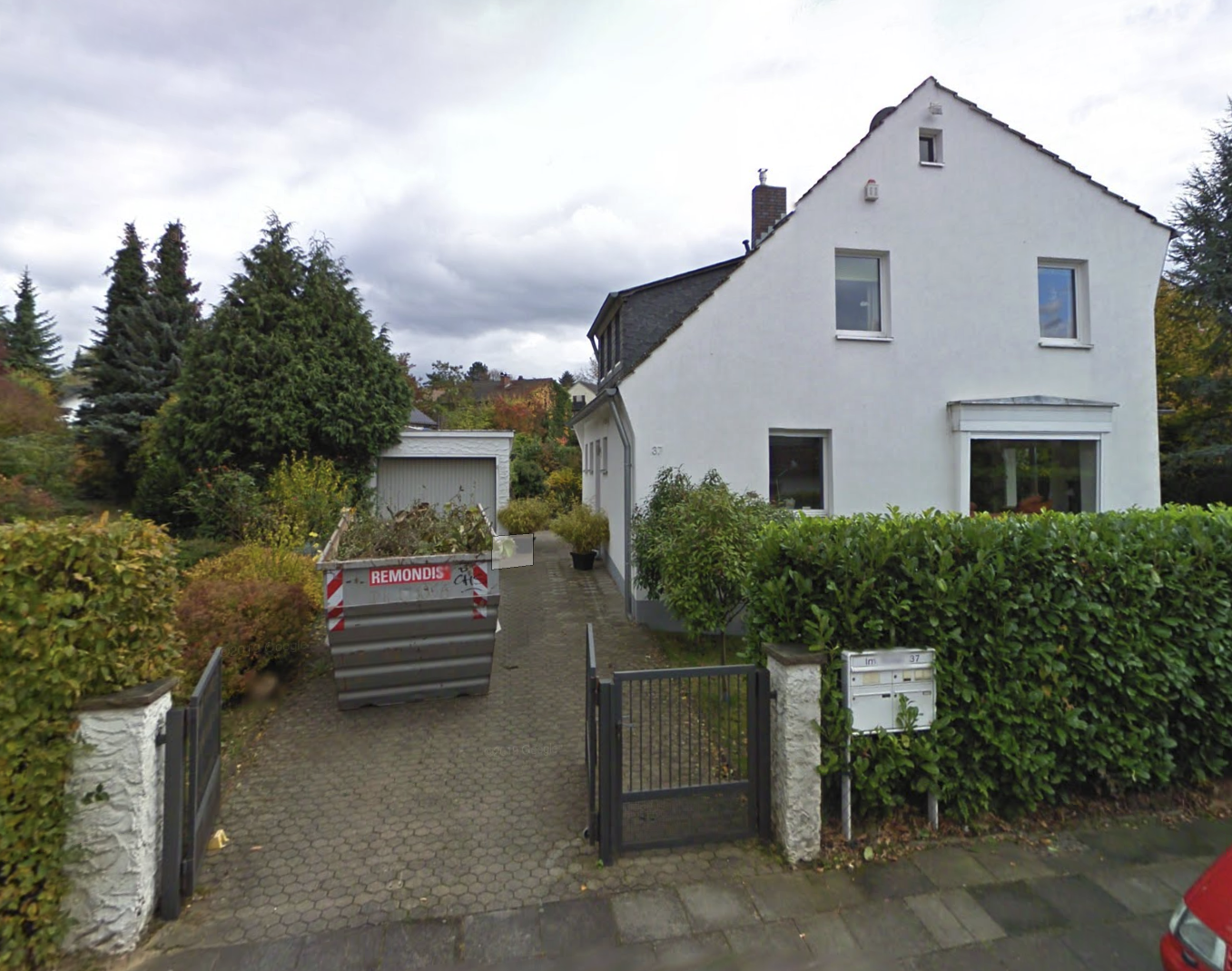
All we have to do now is to find the nearby garage. A short “drive” in Street View shows that the correct house is on the opposite side of the junction at 37 Im Acker. Here’s what it looked like in 2009. You’ll notice there was no graffiti or dog warning sign at that time, but the house number and layout is the same.
Conclusion
Finding a specific garage in a country where there are millions of garages might seem like an impossible task. However by starting big and gradually refining a search to focus on smaller and smaller areas, it is often possible to find what you’re looking for.
For more Quiztime solutions, click here.
🙈🙈🙈👍