Why are all these people parking their cars at a swimming pool in the middle of lockdown? This was the question Lars Wienand posted for yesterday’s Quiztime challenge. Here’s the photo:
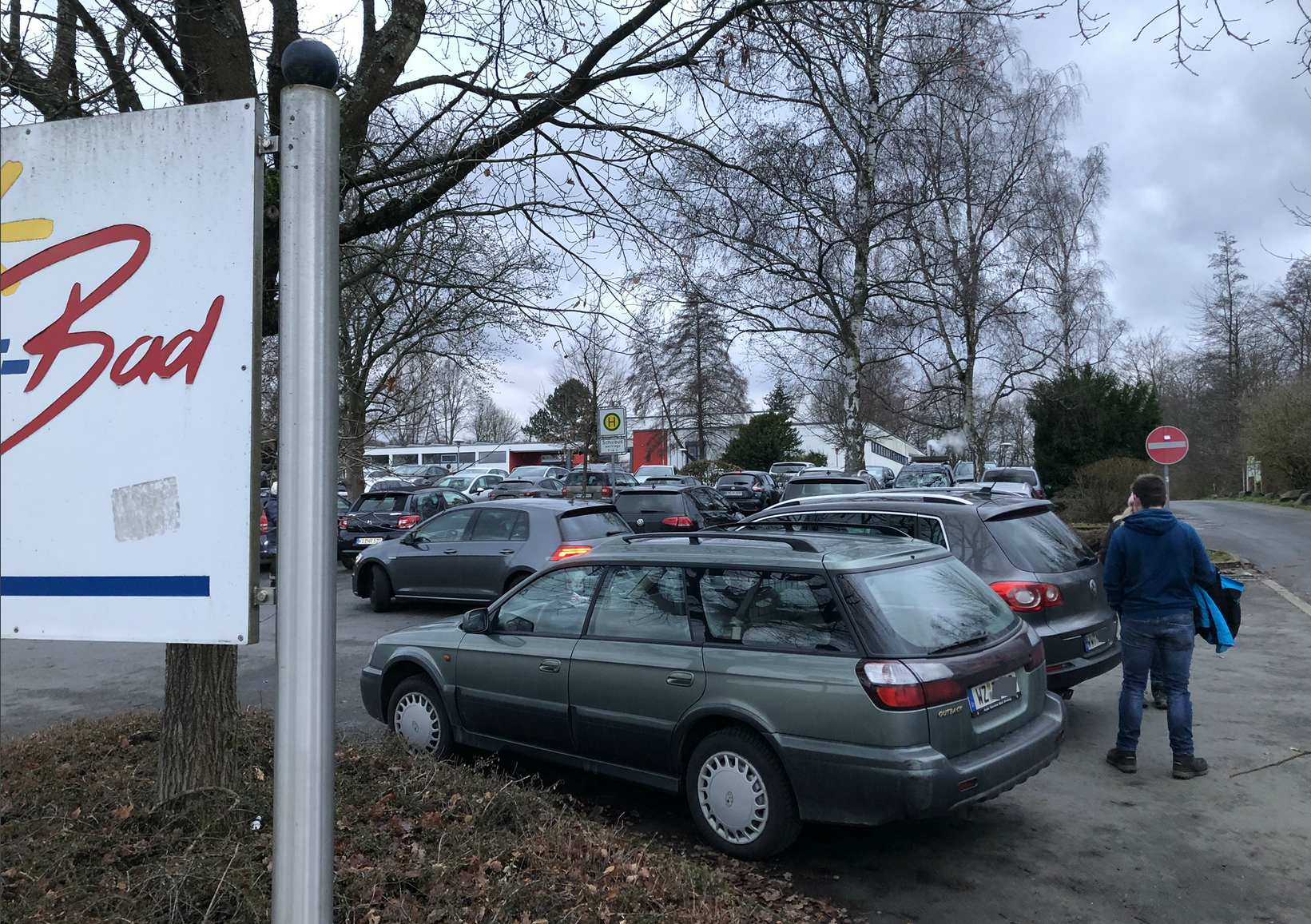
To solve this quiz we need to do two things. First we need to know where this is, and secondly we need to know what’s happening there. We can’t answer the second question until we have answered the first, so we have to start with geolocation.
There are actually two ways to geolocate this image. One is very quick, and the other is slow but possibly more reliable. Let’s have a look at both.
Geolocation Method #1: The Easy Way
Reverse image search can be hit or miss when it comes to image geolocation. In this case it’s a very quick hit. I like to use the excellent Search By Image tool so that it’s easy to conduct a reverse image lookup with multiple search engines at once with just a couple of clicks.
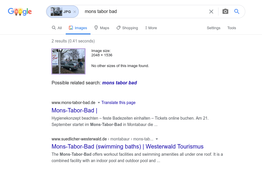
Google reverse image search identified the location as Mons Tabor Bad in Montabaur, Germany.
We still need to try and verify this before being certain it is the right place. There’s no Street View available but photos of the location on Google Maps show a match for the building in the background of the original image as well as the logo.
So the original image looks like it was taken in the car park at Mons Tabor Bad. Before we find out why people are there, I think it’s worthwhile looking at other means by which this image can be geolocated.
Geolocation Method #2: The Hard Way
Why would you want to make geolocation harder than it needs to be? Tools like reverse image search or Google Lens may make geolocation very quick and easy, but most of the time they will not help you find what you are looking for. More often it is necessary to pick out clues from the image and the context in which it was found and work from there.
So how could we solve this quiz if we weren’t so lucky with a reverse image search? What information is there in the photo that can help us find out where it was taken?
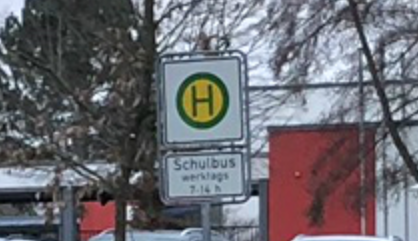
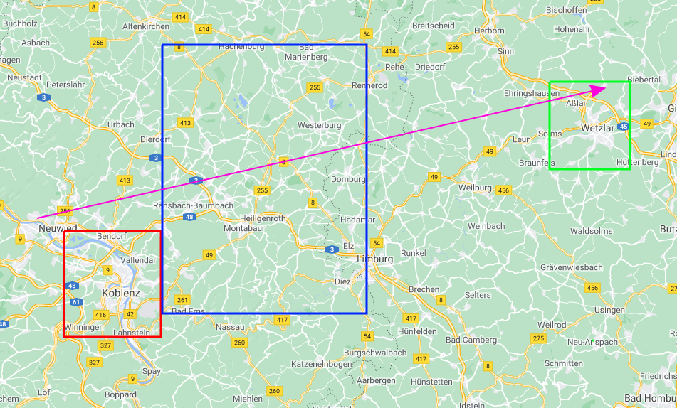
The ‘H’ sign is German (Haltestelle – bus stop) and the writing underneath says Schulbus (School Bus) – also in German. But where in Germany? The car registrations are helpful here. German car registrations are organised by region, with the first part of the registration relating to a specific area. So B denotes Berlin, H is for Hannover, AC is for Aachen, and so on. There’s a full list here. (You should probably bookmark that site if you do Quiztime regularly…)
The visible car registrations are for KO (Koblenz, red square), WW (Westerwaldkreis, blue square) and WZ (Wetzlar, green square). If we check out these locations on Google Maps we can see that they are all in roughly the same area of western Germany.
Lars has already told us that the location is a swimming pool, and we can see part of the “Bad” (pool/spa/bath) sign in the photo. So all we need to do is find all the keyword matches for “Bad” in this part of Germany and see if they look like the one in the picture.

This might sound very time consuming but with Google Maps we can do this quite quickly by entering the “Bad” search term and then scrolling left to right (pink arrow) through the search area we identified from car registrations.
Ensure that the box “Update results when map moves” is ticked:

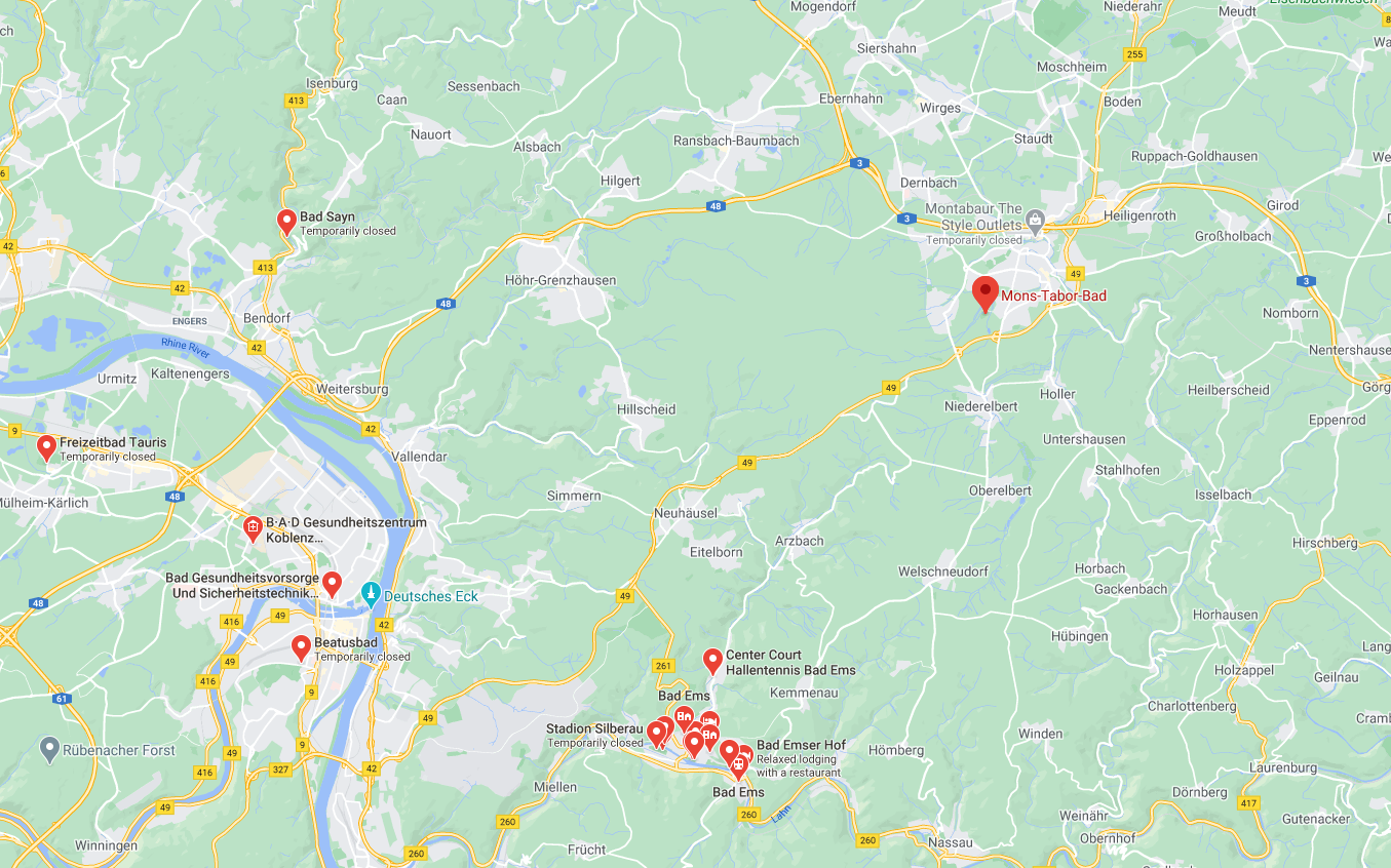
Then as we scroll all the matches for “Bad” are highlighted. There are some false positives since “Bad” can have other meanings, but most of the matches refer to swimming pools. We don’t have to venture very far from the starting point in Koblenz to find a matching pool.
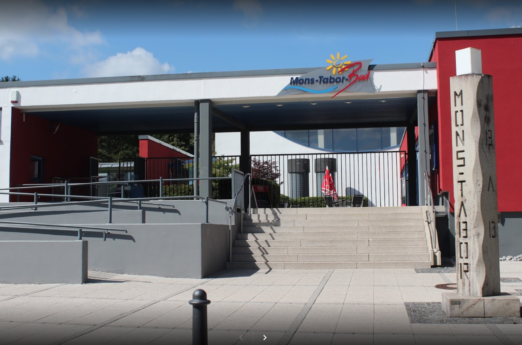
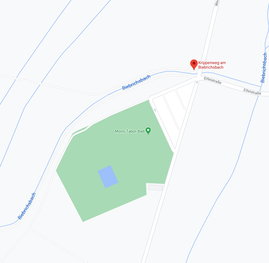
Clicking on the keyword match at Mons-Tabor-Bad brings up a Google entry with this matching image:

It’s a different method to reverse image searching, but it leads to the same location. The second technique is slower but is more reliable in situations where there is no quick fix.
The second technique will also lead us to the final answer much more quickly.
What Is Going On?
We can continue with Google Maps to find the answer to why so many people are parked at the pool. At the same location on Google Maps there’s mention of “Krippenweg Am Biebrichsbach”. “Krippen” is German for “cribs”, so Krippenweg means “crib path” or “crib way”. Am Biebrichsbach just refers to the small river at that location.
Google Maps also shows us photos that people have uploaded at the location. They can be sorted by “Latest”, so we can see what photos people have posted there in the few days before Lars’ quiz.
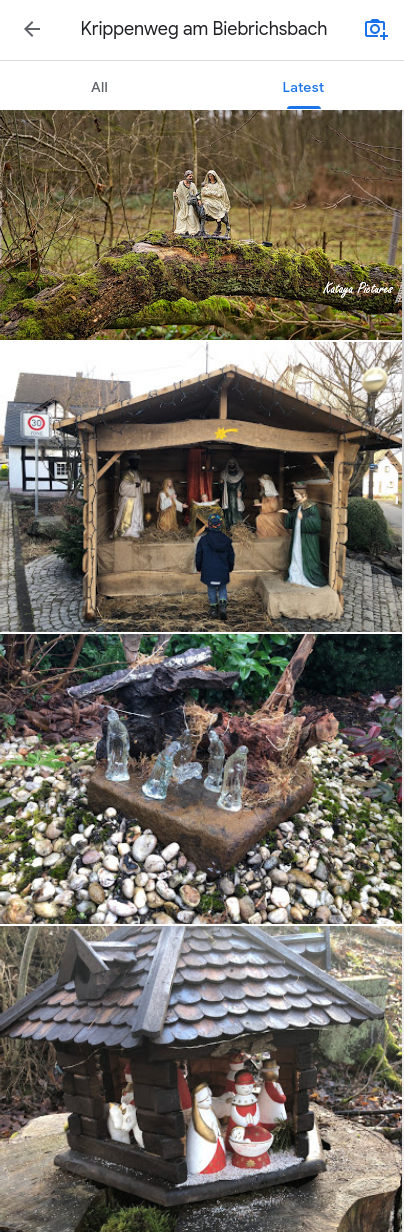
Lots of Krippen (cribs). There’s even a picture of one of the cribs if we click on the Google Maps entry of the swimming pool itself.
So it seems that the main reason people are parked at the pool is not because they are going swimming (and the pool’s website tells us that the pool is closed anyway) but because they are going to walk along the Krippenweg and see all the nativity scenes.
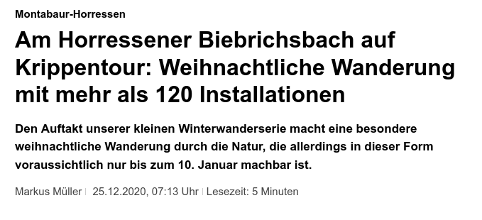
For a little final extra verification we can search for local news articles which mention the pool. This article tells us that the “Crib Tour” along the Biebrichsbach features more than 120 crib scenes and will run until 10th January.
For my other Quiztime write-ups, click here.